

Back to futurelearn
Topic 1C – The Role of Copernicus Services and Partners In Managing Big Data
Featured Images and Example Data

Hyperspectral Data Fusion
Example of data fusion - hyperspectral remote sensing imagery and topographic indices are 'fused' together to improve classification of habitats
©
Adriana Marcinkowska-Ochtyra, et al., 2019
Source LinkFeatured Video and Animations


Sentinel-3 Microwave Radiometer
Animation of Sentinel-3 which has a synthetic aperture radar altimeter that is used to measure sea-surface height, ocean-surface waves, the extent and height of sea ice, and the height of large inland rivers and lakes
©
ESA/ATG medialab
Source Link
Copernicus Sentinel-6 ready for launch
Video showing the final preparations for the launch of Sentinel-6
©
ESA
Source Link

Sentinel-3 scans Earth's colour
Animation of Sentinel-3 using it's Ocean and Land Colour Instrument (OLCI) instrument
©
ESA/ATG medialab
Source Link
Storm Alex - Meteosat 11
This is a series of Meteosat 11 images overlaid with H SAF Precipitation rate at ground during Storm Alex over France from 1 October - 4 October 2020
©
EUMETSAT
Source Link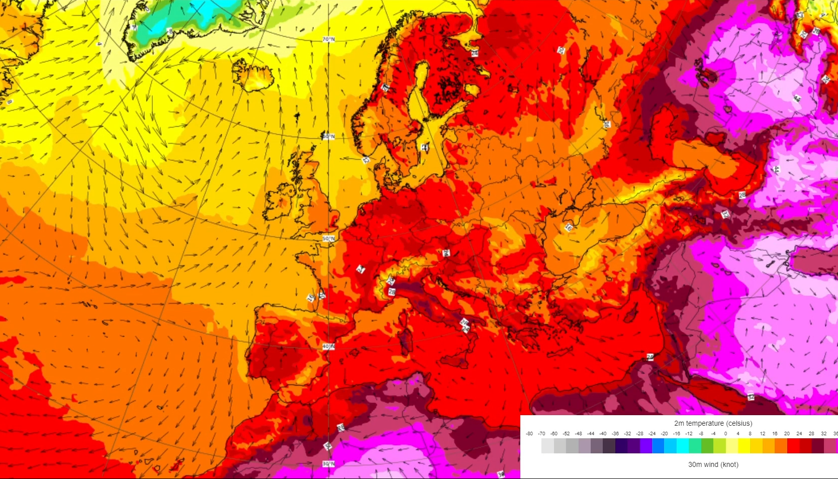
ECMWF temperature and winds forecast
This is a ECMWF 2m temperature (colour shading,) and 30m winds (shown as black arrows) forecast for 2nd - 12th June 2021
©
ECMWF
Source Link
Sign up to our newsletter to get updates from Imperative MOOCs
Thank you! Your submission has been received!
Oops! Something went wrong while submitting the form.