

Back to futurelearn
Topic 2F – Ethical Considerations
Featured Images and Example Data
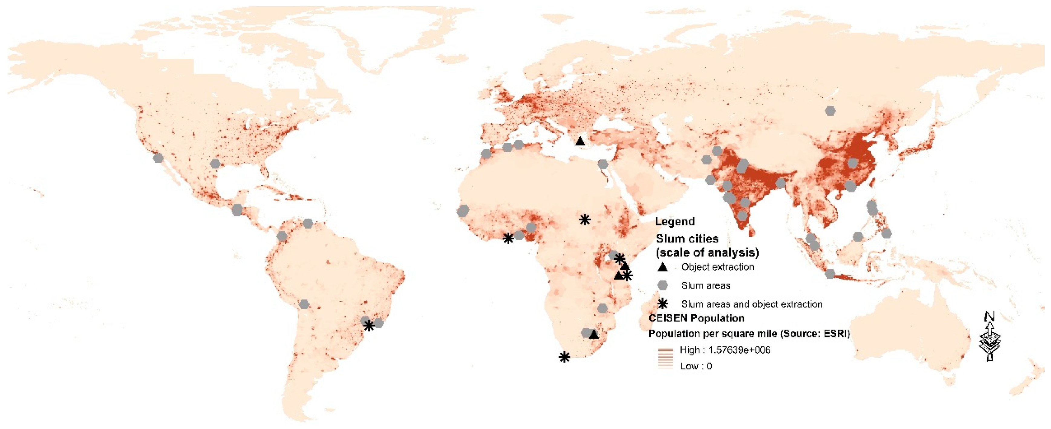
World Slums map
Locations of Slums mapped from Remote Sensing found in English-language publications, on top of a population density map
©
Monika Kuffer, et al., 2016
Source LinkFeatured Video and Animations

Sentinel-3 Microwave Radiometer
Animation of Sentinel-3 which has a synthetic aperture radar altimeter that is used to measure sea-surface height, ocean-surface waves, the extent and height of sea ice, and the height of large inland rivers and lakes
©
ESA/ATG medialab
Source Link
Sign up to our newsletter to get updates from Imperative MOOCs
Thank you! Your submission has been received!
Oops! Something went wrong while submitting the form.