Back to futurelearn

Topic 3A - Introduction To Monitoring The Land

Featured Images and Example Data
Summary of the European Green Deal
The European Green Deal
Summary of the European Green Deal

©

European Commission, 2019
Source Link
These 3 images show the mapping out of small woody features in an area of France. This data is from the 2015 'HRL Small Woody Features (SWF) Copernicus Land Monitoring Service data set'
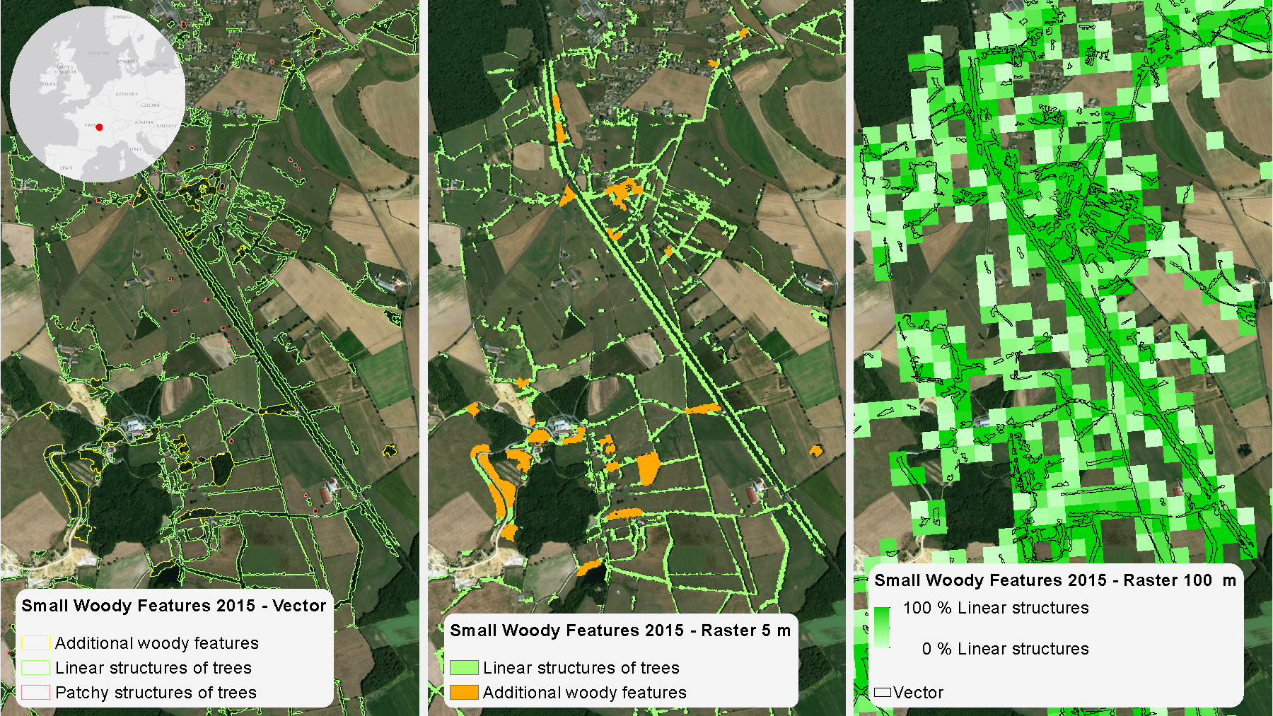
Small woody features for agro-environmental status
These 3 images show the mapping out of small woody features in an area of France. This data is from the 2015 'HRL Small Woody Features (SWF) Copernicus Land Monitoring Service data set'

©

Copernicus Land Monitoring
Source Link
 Location of a study area in Croatia used for a tree classification study using remote sensing and ML
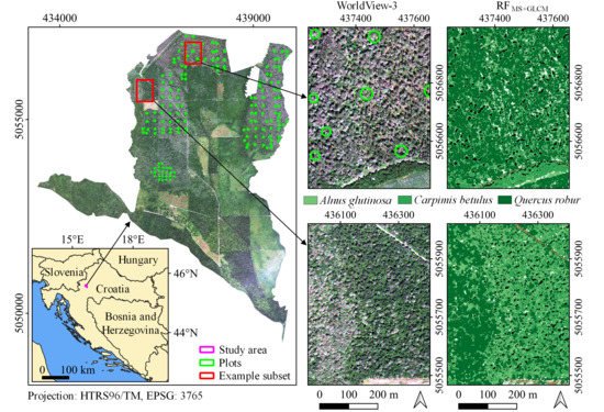
Tree classification study
Location of a study area in Croatia used for a tree classification study using remote sensing and ML

©

Martina Deur, et al., 2020
Source Link
Featured Video and Animations
Animation of Tropomi unfolding on Sentinel 5p
Sentinel-5p Tropomi unfolds
Animation of Tropomi unfolding on Sentinel 5p

©

ESA
Source Link
ESA visual video on land use change
Changing Lands
ESA visual video on land use change

©

ESA/Planetary Visions
Source Link
Learn more about Sentinel-1
Sentinel-1 Radar Mission
Learn more about Sentinel-1

©

ESA
Source Link
Visit Imperative.space
Privacy Policy Cookie Policy
Sign up to our newsletter to get updates from Imperative MOOCs
Thank you! Your submission has been received!
Oops! Something went wrong while submitting the form.
Support / Feedback

© Imperative Space 2024 | All Rights Reserved