

Back to futurelearn
Topic 3D: Part 1 - AI for Agriculture: Precision Farming
Featured Images and Example Data
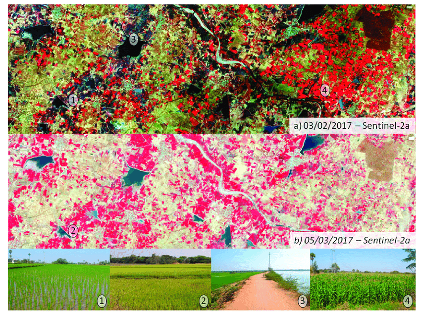
Crop identification using optical Sentinel-2
Crop identification using optical Sentinel-2 time series. The top image (a) shows the mature growth stage of irrigated maize fields in red, and the early growth stage of flooded rice in brown. The middle image (b) shows developed rice in red areas.
©
Sylvain Ferrant, et al., 2017
Source Link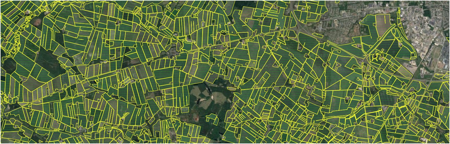
Spacenus Precision Farming
ESA BIC Hessen & Baden Württemberg start-up Spacenus improves precision farming with their Artificial Intelligence (AI) augmented system for automating field geometrics, plant nutrient detection and more.
©
Spacenus
Source Link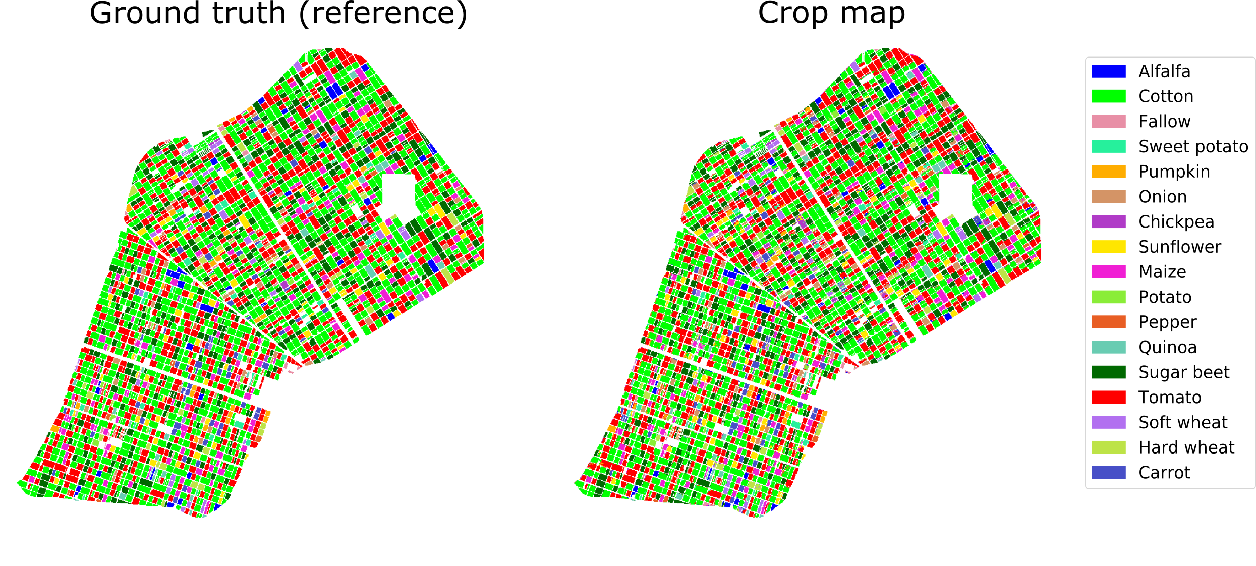
Crop-type map
This is an example of crop-type mapping using Sentinel-1 satellite imagery
©
Ground truth data: Regional Government of Andalusia. Crop map: contains modified Copernicus Sentinel data (2017), processed by University of Alicante
Source Link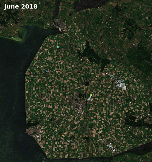
Crops in the Netherlands
This animation shows early season crop type classification in the Emmeloord region of the Netherlands in June 2018 based on Copernicus Sentinel-2 data. Green shows summer crops, red: potatoes, orange: vegetables and flowers, yellow: cereals, and blue: grass.
©
contains modified Copernicus Sentinel data (2018), processed by ESA/GeoVille
Source LinkFeatured Video and Animations
No items found.

Sign up to our newsletter to get updates from Imperative MOOCs
Thank you! Your submission has been received!
Oops! Something went wrong while submitting the form.