

Back to futurelearn
Topic 3F - Mapping The Extent of Forest Fires
Featured Images and Example Data
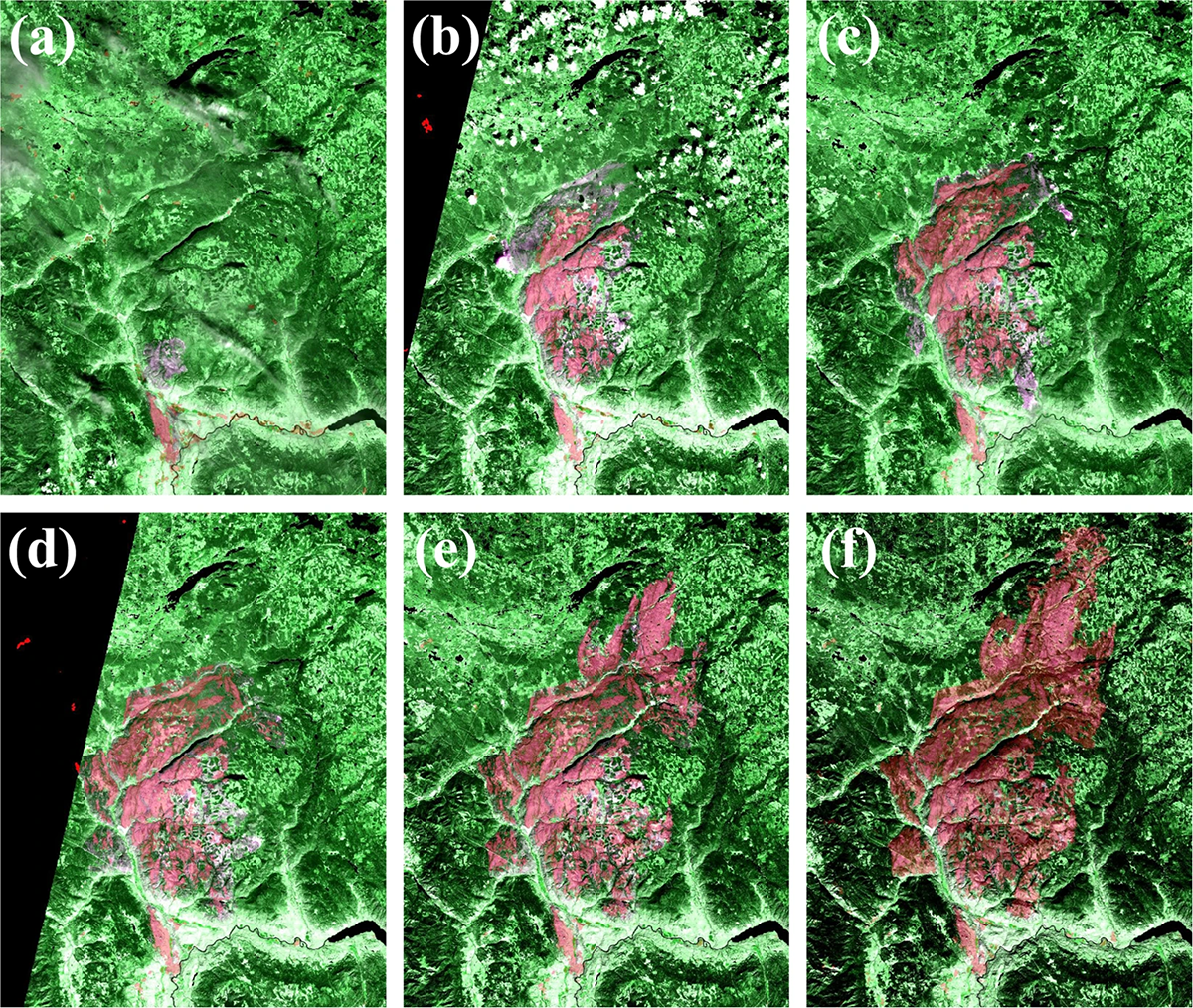
Sentinel-1 fire progression
Sentinel-1 based wildfire progression maps in the Elephent Hill, British Columbia, Canada, in 2017 (Convolutional Neural Network in transparent red) overlaid on the Sentinel-2 MSI false color composites
©
Yifang Ban, et al., 2020
Source Link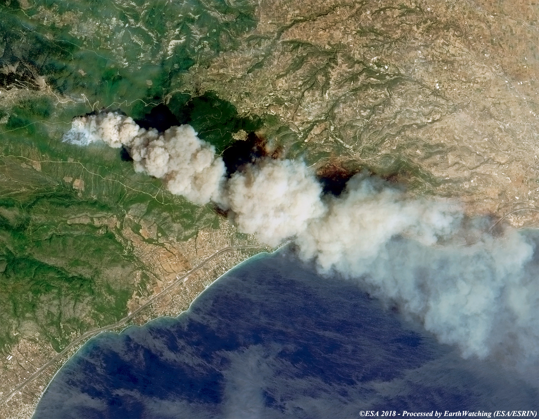
Kineta, Greece Forest Fire
This image shows a smoke plume from a fire in Kinata, Greece in July 2018, taken by Sentinel-2
©
ESA/ESRIN
Source Link
Smoke Blankets over Borneo, Indonesia
The Moderate Resolution Imaging Spectroradiometer (MODIS) on NASA’s Aqua satellite captured this image of Borneo on September 15, 2019. Smoke hovered over the islands and triggered air quality alerts and health warnings in the region.
©
NASA
Source Link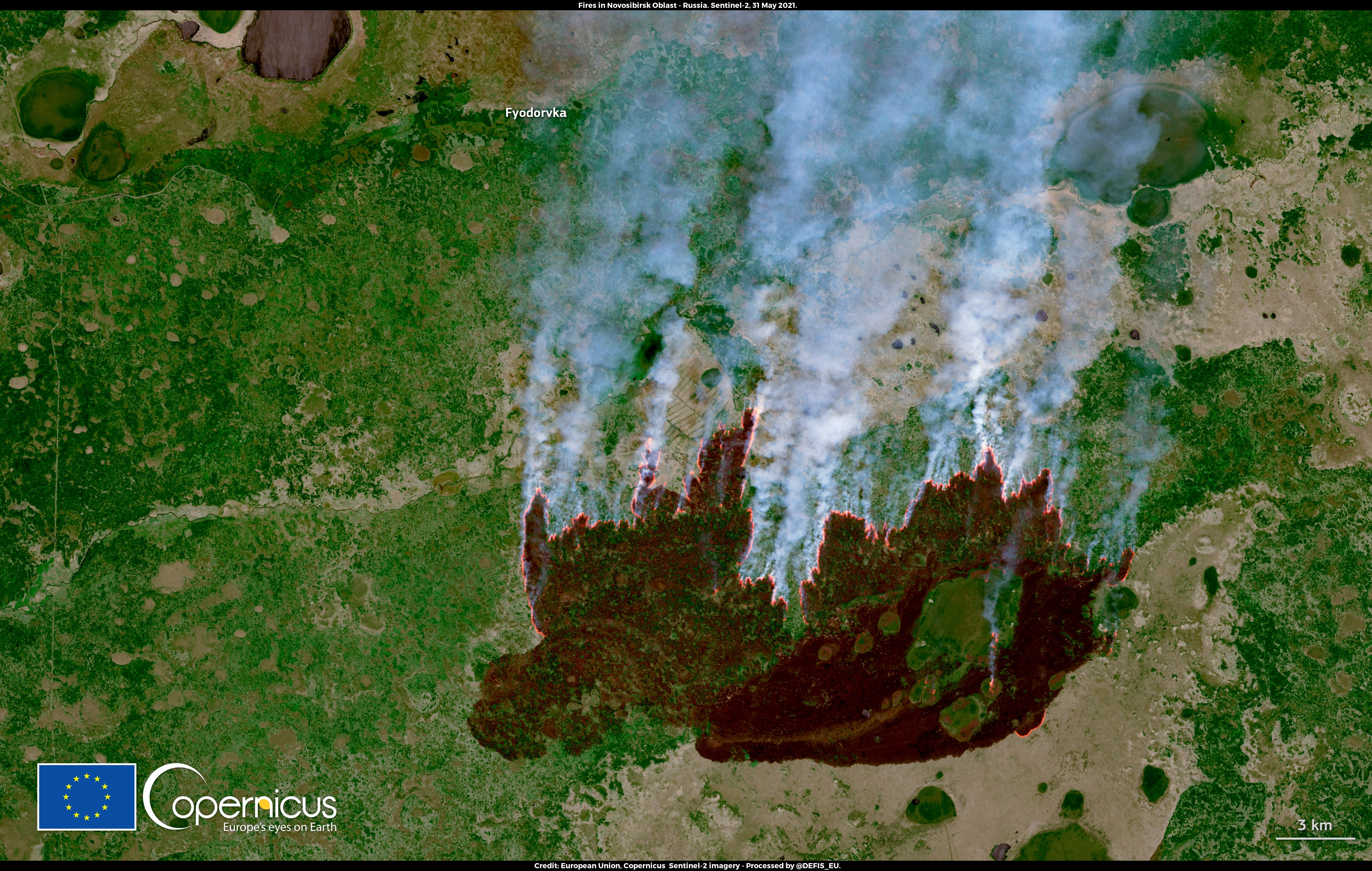
Siberian Fires - June 2021
Multiple fires are ongoing in southwestern Siberia after the Heatwave that affected central Russia in late May 2021. Sentinel- 2 image showing a the wildfire active in the region of Novosibirsk
©
EU Copernicus Sentinel-2 imagery
Source Link
Oil palm fires, Borneo
Fires burning in several oil palm areas in southern Borneo in September 2019
©
NASA Earth Observatory
Source Link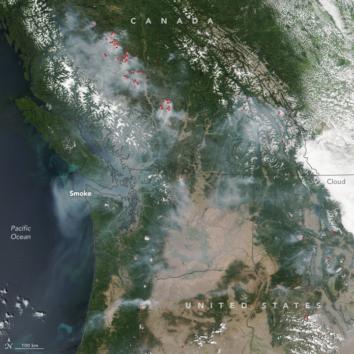
Smoke Spreads Across the U.S. and Canadian West
Wildfire smoke spreading across the US and Canada, August 4, 2017
©
NASA image by Jeff Schmaltz, LANCE/EOSDIS Rapid Response
Source LinkFeatured Video and Animations

Sentinel-1 Forest monitoring
This is an illustrative video of Sentinel-1 monitoring forests
©
ESA
Source Link

Sign up to our newsletter to get updates from Imperative MOOCs
Thank you! Your submission has been received!
Oops! Something went wrong while submitting the form.