

Back to futurelearn
Topic 4C - Marine Safety
Featured Images and Example Data
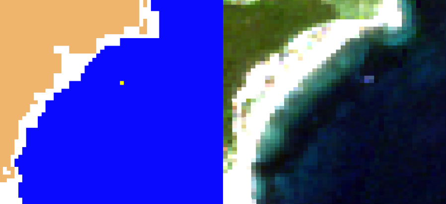
Floating plastic target off Tsamakia Beach, Greece
An output image from the processor side-by-side with a true colour RGB composite from Copernicus Sentinel-2 of the plastic target. The Copernicus Sentinel-2 pixel, mostly covered by the target, is flagged by the processor in yellow, as likely containing plastic.
©
Contains modified Copernicus Sentinel data (2019)/processed by ARGANS Limited Drone image – University of Aegean
Source Link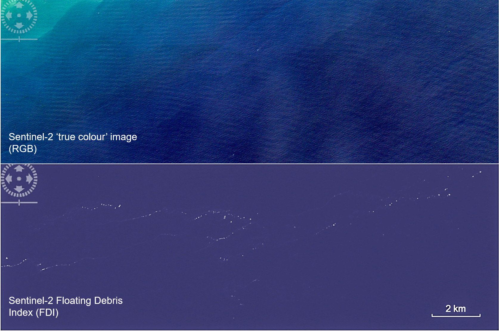
Plastic pollution - Ghana
Sentinel-2 imagery of plastic pollution off the coast of Ghana. The top image is an enchanced 'true colour' image, and the bottom image uses the Floating Debris Index (FDI) which helps the plastic debris become more visable
©
Lauren Biermann / PML
Source Link.png)
Identifications of marine litter accumulations in the Mediterranean Sea
Top: A frontal area east of the Po River Delta, Italy. Bottom: litter strands after land-based rainfall events on an area south Calabria, Italy (bottom left image has been processed with the sea mask removed to show visible RGB rendering of the sea surface, where floating marine debris can be seen highlighted in red).
©
Contains modified Copernicus Sentinel data (2018) processed by ARGANS Ltd in the European Space Agency project EO tracking of marine debris in the Mediterranean Sea
Source Link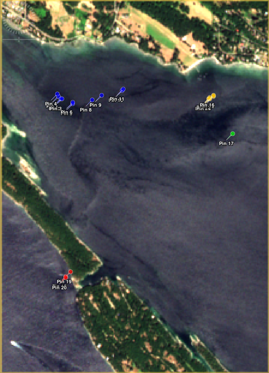
Aggregations of mixed floating material
Aggregations of mixed floating material off the south Gabriola Island coastline, Canada, with a number of bright pixels pinned in different colours to differentiate aggregations or patches.
©
Copernicus Sentinel-2 image processed by PML in the European Space Agency project OPTIMAL (data analysis supported also by NEODAAS-NERC, UK)
Source Link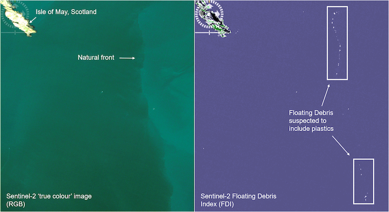
Plastic pollution off the coast of Scotland
Sentinel-2 imagery of plastic pollution off the coast of Scotland. The left image is an enchanced 'true colour' image, and the right image uses the Floating Debris Index (FDI) which helps the plastic debris become more visable
©
Lauren Biermann / PML
Source Link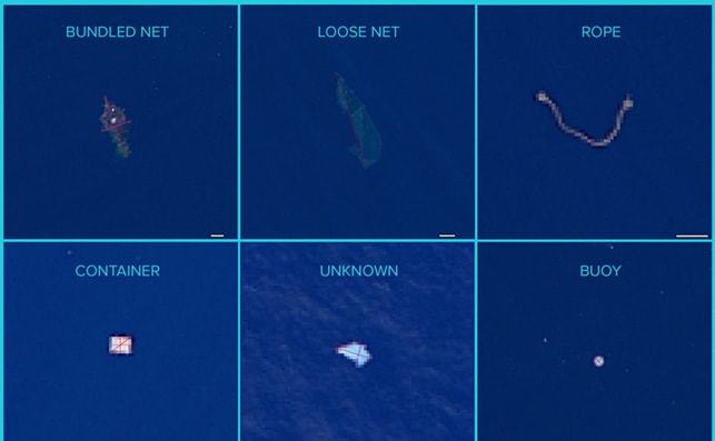
Aerial images - Marine litter
Aerial images of large ML items taken by a high resolution camera over the Great Pacific Garbage Patch.
©
Ian Carnelli, et al., 2018
Source Link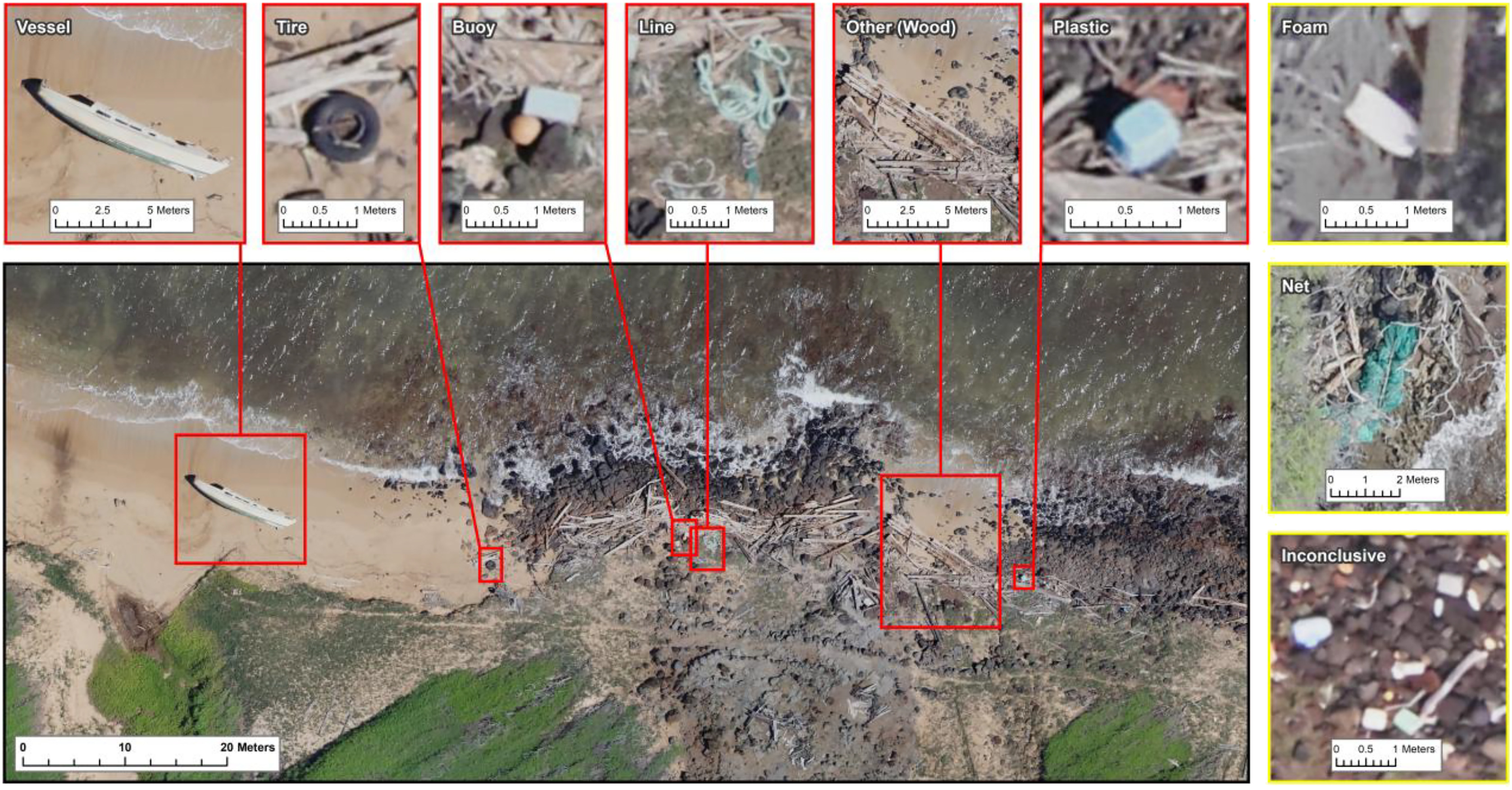
Mapping coastal debris
Aerial imagery used for mapping coastal debris
©
Kirsten Moy, et al., 2018
Source Link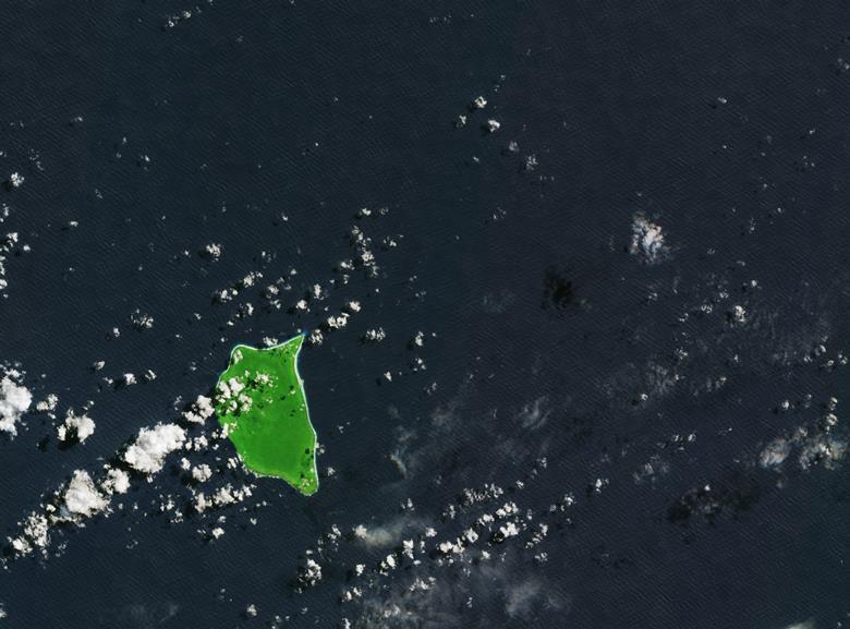
Henderson Island
Henderson Island, captured by the Copernicus Sentinel-2B satellite on 22 March 2018. On Henderson Island , items from as far afield as Russia, USA, Europe and South America have been found.
©
contains modified Copernicus Sentinel data (2018), processed by ESA, CC BY-SA 3.0 IGO
Source Link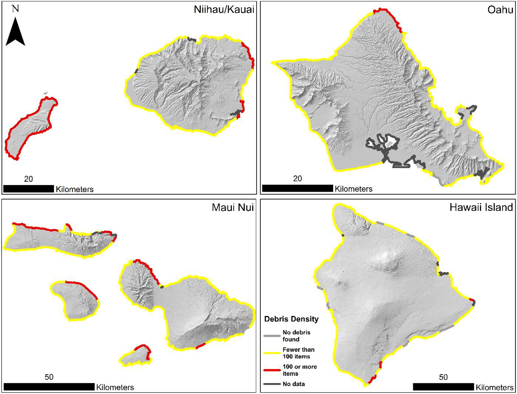
Debris Density Mapping
Density and distribution of debris on the main Hawaiian Islands
©
Kirsten Moy, et al., 2018
Source Link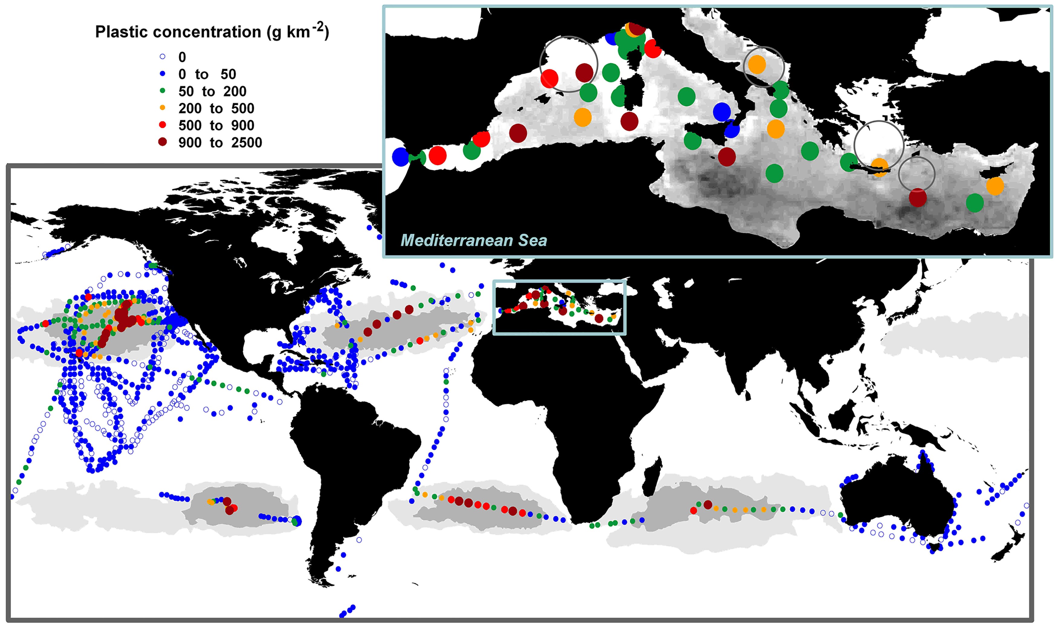
Plastic litter in global oceans
Concentrations of plastic litter in surface waters of the global ocean and the Mediterranean Sea at basin scale
©
Cozar et al., 2015
Source LinkFeatured Video and Animations


Sign up to our newsletter to get updates from Imperative MOOCs
Thank you! Your submission has been received!
Oops! Something went wrong while submitting the form.