

Back to futurelearn
Topic 4G - Using ML To Combine Water Quality Data From Different Satellites
Featured Images and Example Data
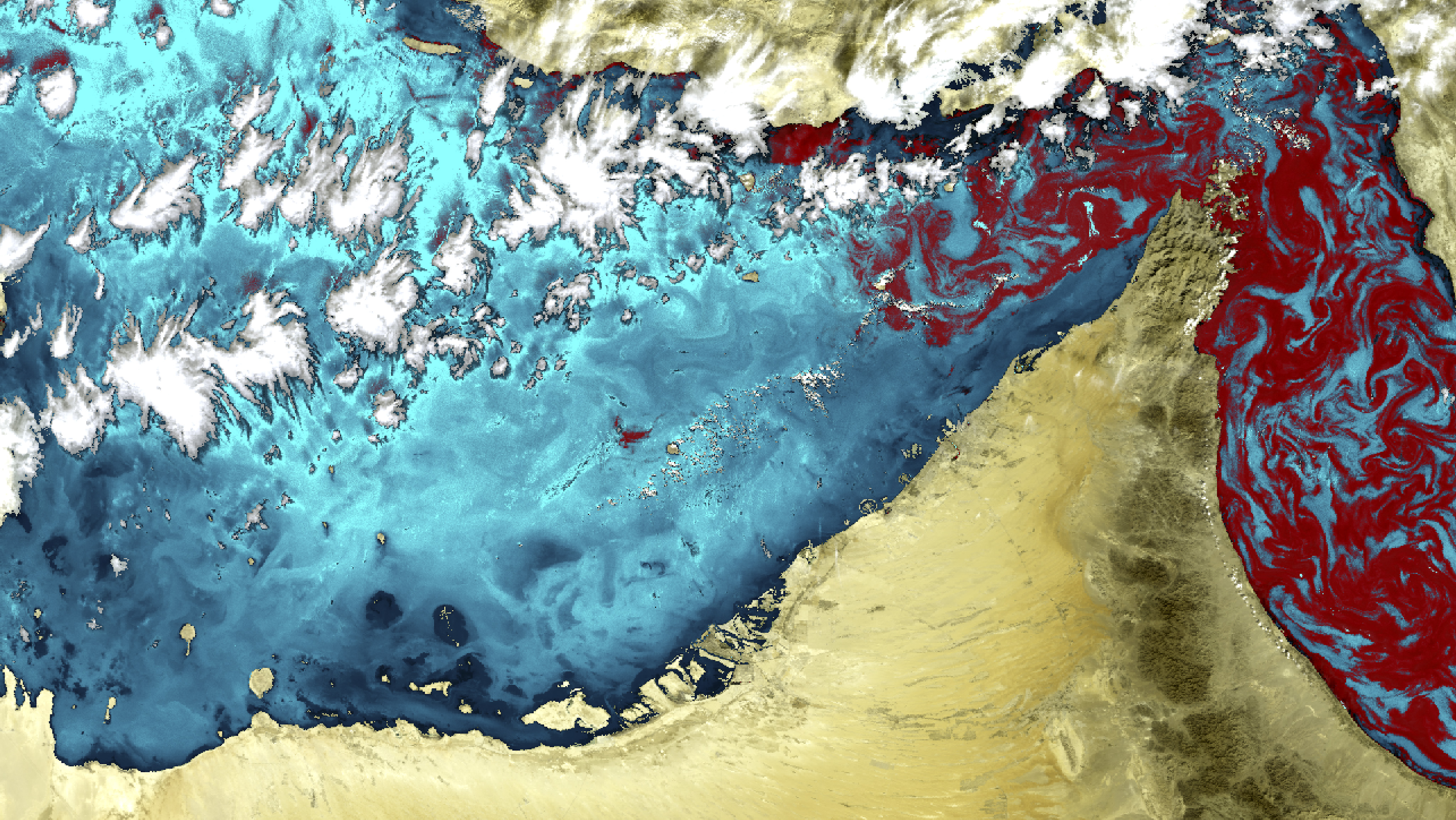
Red tide
This image shows a 'red tide' spreading from the Gulf of Oman into the Persian Gulf. This image was acquired by Envisat’s MERIS instrument on 22 November 2008.
©
C-wams project, Planetek Hellas/ESA
Source Link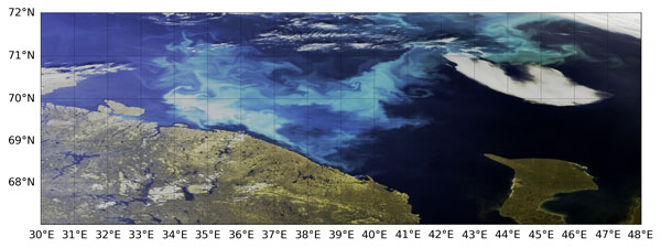
Phytoplankton Blooms spotted by Sentinel-3
Coccolithophores in the Barents Sea, using Sentinel-3A OLCI Level 1 data from 30 July 2018.
©
EUMETSAT/Copernic Sentinel-3
Source Link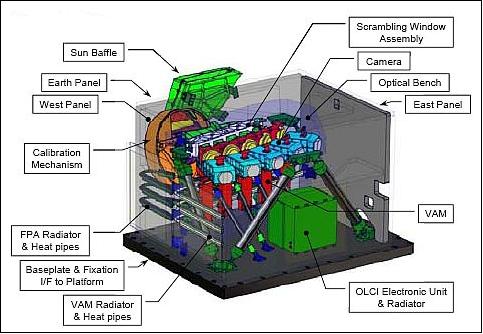
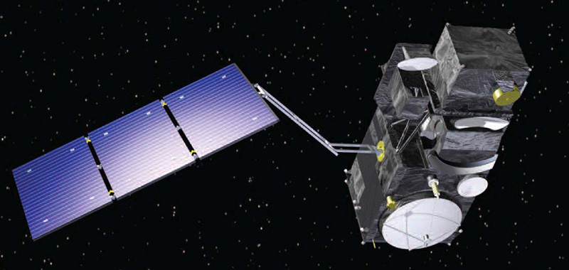
Sentinel-3 OLCI
Artist's rendition of the Sentinel-3 spacecraft with the OLCI instrument
©
ESA
Source Link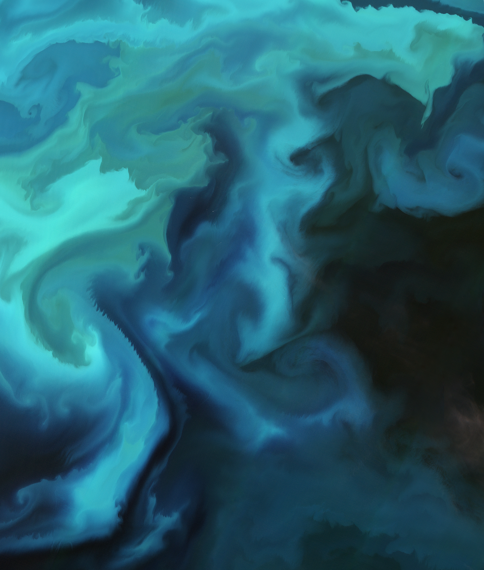
Barents bloom
This image is a natural-colour capture of a plankton bloom in the Barents Sea taken by the Sentinel-2A satellite.
©
Contains modified Copernicus Sentinel data (2016), processed by ESA
Source Link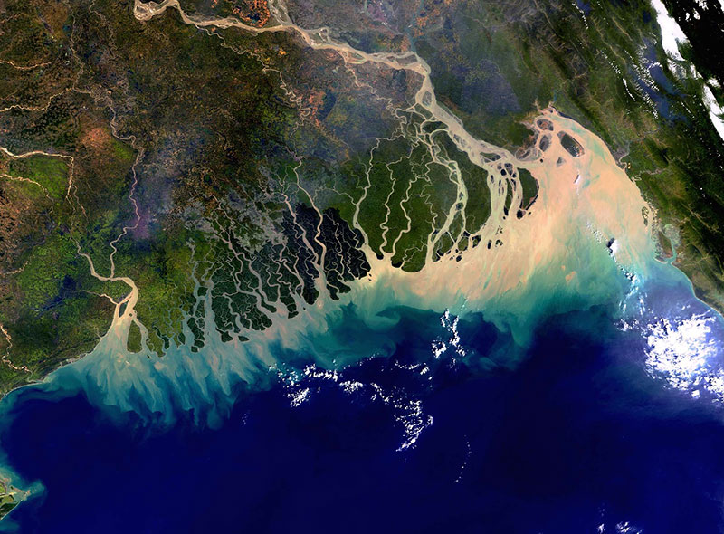
The Bangladesh coastline seen by Envisat
A colourful view of the Bangladesh coastline seen by Envisat's Medium Resolution Imaging Spectrometer (MERIS). The image was acquired on 8 November 2003 in Full Resolution mode, providing a spatial resolution of 300 metres and covering approximately 633 km by 630 km.
©
Contains modified Copernicus Sentinel data (2016), processed by ESA
Source Link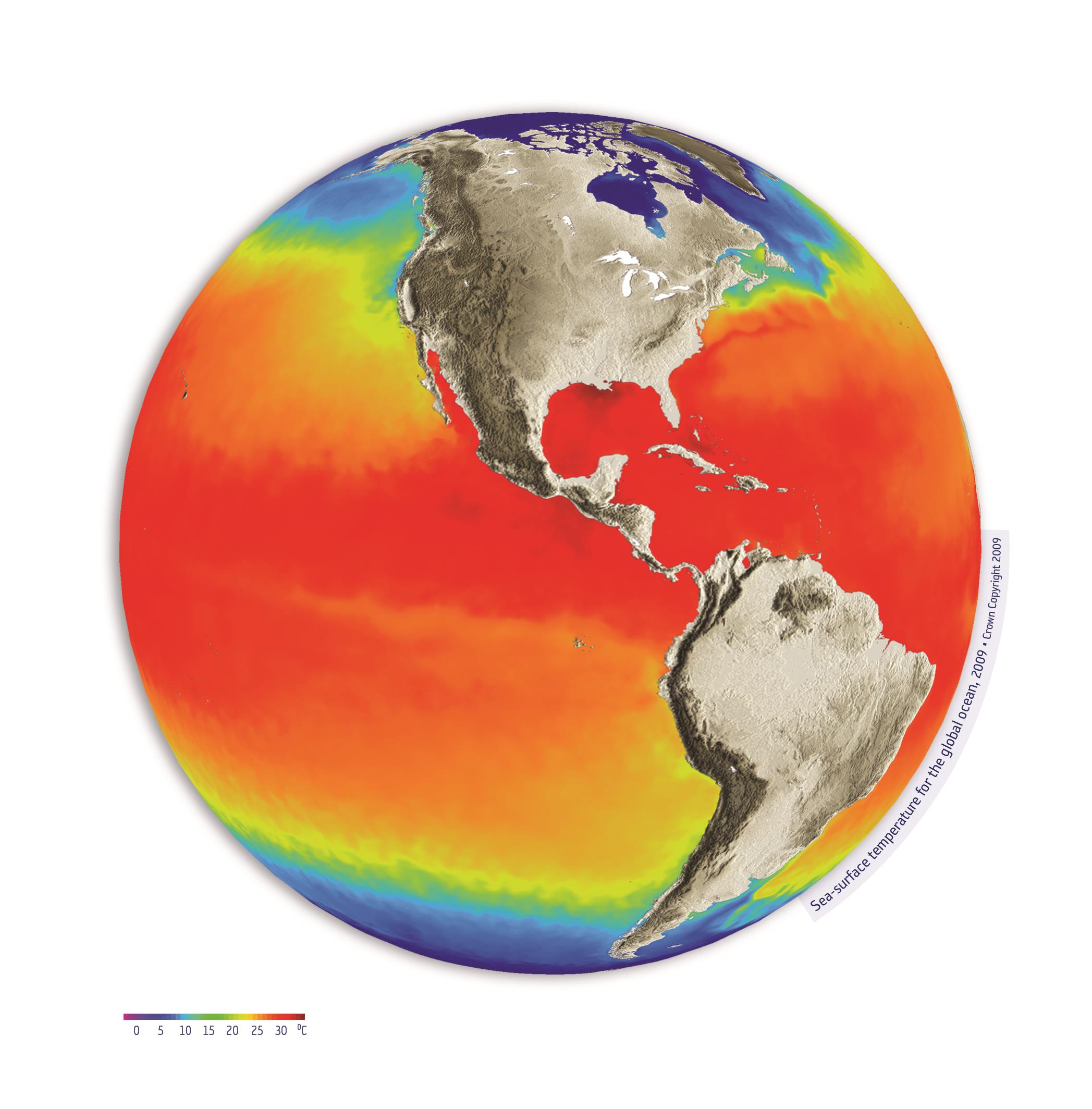
Sea-surface temperature
The Sentinel-3 radiometer will provide sea-surface temperature measurements in near-real time. These measurements are needed by operational oceanographic and weather forecasting centres.
©
Crown Copyright, 2009
Source Link
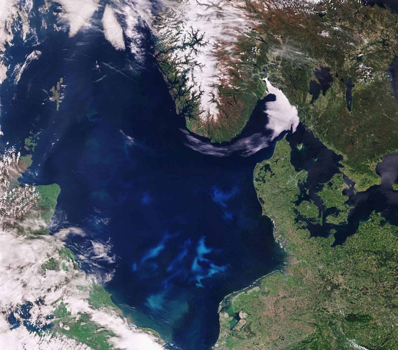
Clouds Over Southern Indian Ocean
This image of clouds over the southern Indian Ocean was acquired on July 23, 2007 by one of the backward (northward)-viewing cameras of the Multi-angle Imaging SpectroRadiometer (MISR) instrument on NASA’s polar-orbiting Terra spacecraft.
©
NASA/JPL-Caltech
Source Link
OLCI Level 2 CHL Concentration - Sentinel-3
This Ocean Colour product represents the algal pigment (Chlorophyll a) concentration in clear open waters
©
EUMETSAT
Source Link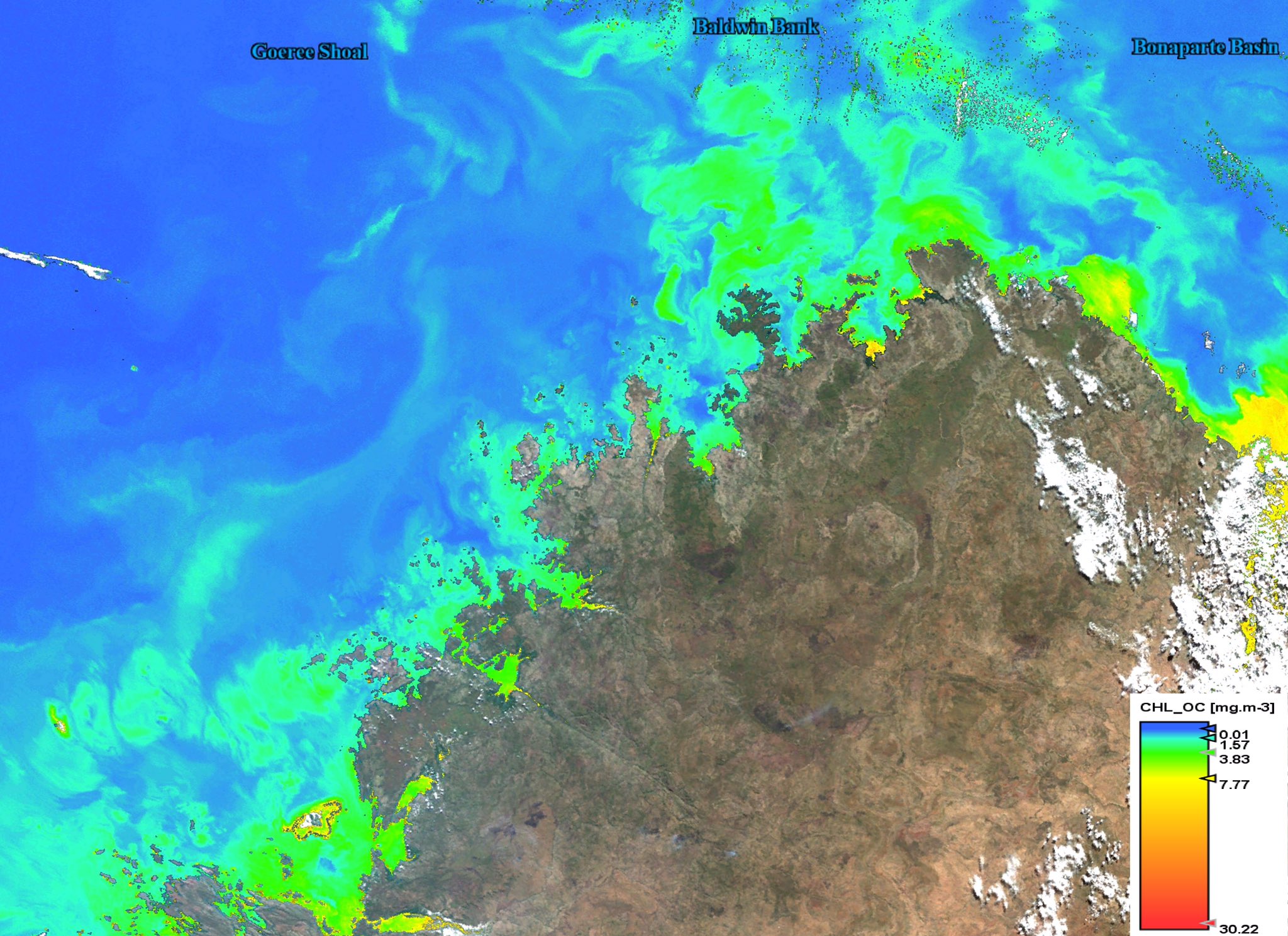
Sentinel3 OLCI Chlorophyll concentration
Chlorophyll concentration product on NW Autralian coast as measured on 19 May 2019. Retrieved using the EUMETSAT CODA data hub
©
Copernicus Sentinel-3/EUMETSAT
Source Link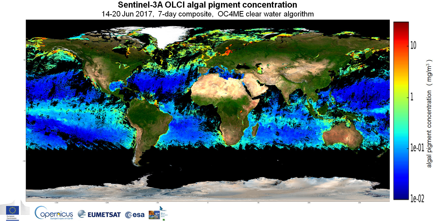
Sentinel-3 OLCI algal pigment concentration
Sentinel-3 OLCI global algal pigment concentration, from 14 - 20 June 2017, using the OC4ME clear water algorithm
©
Copenicus
Source Link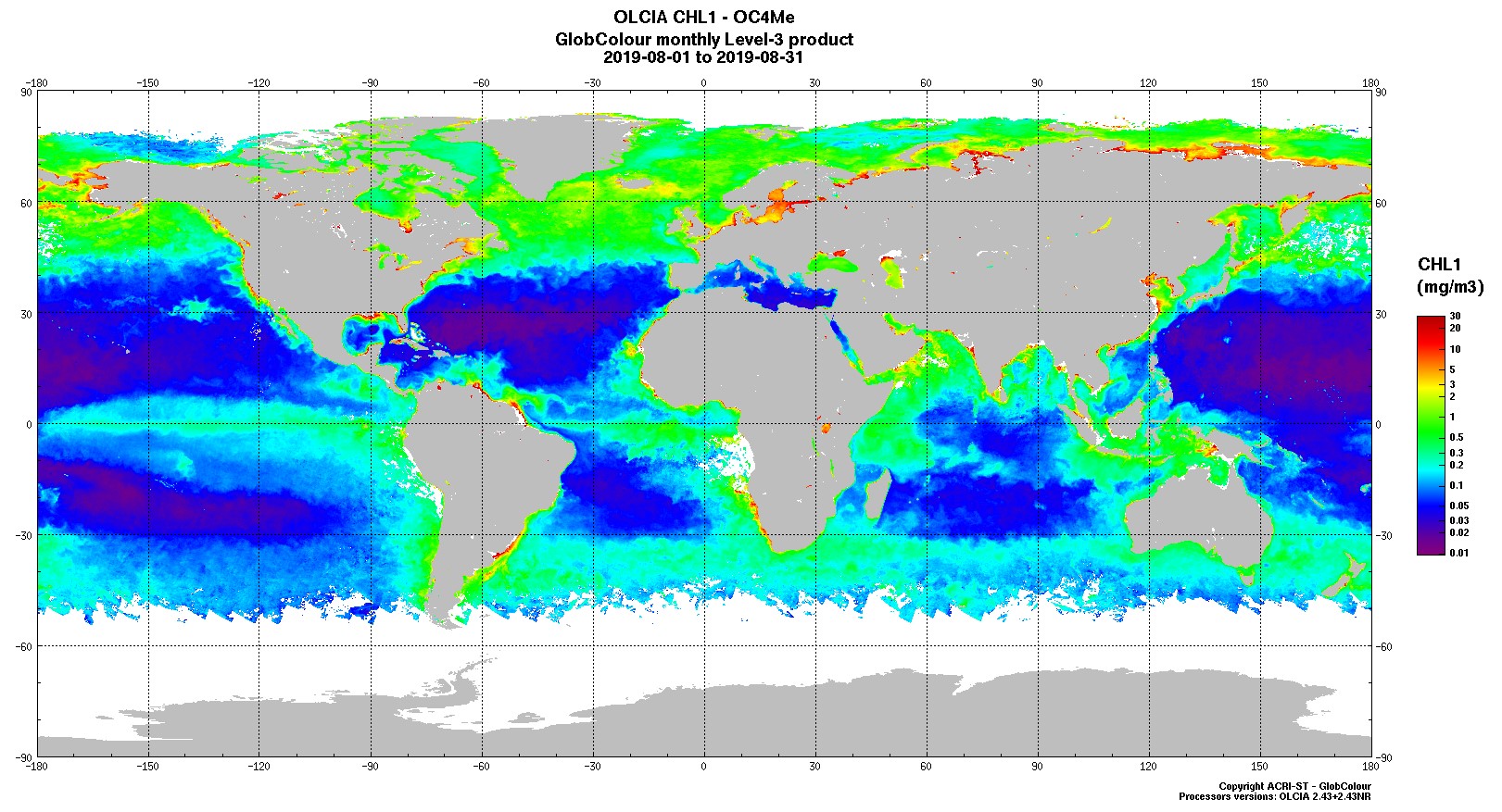
GlobColour Chlorophyll Monthly Product from OLCI-A
GlobColour Chlorophyll Monthly Product from Sentinel-3 OLCI-A
©
ACRI-ST
Source Link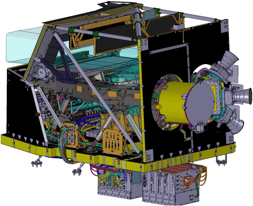
The MultiSpectral Instrument (MSI)
Illustration of the Multispectral Instrument (MSI) on-board Sentinel-2
©
Airbus Defence and Space
Source Link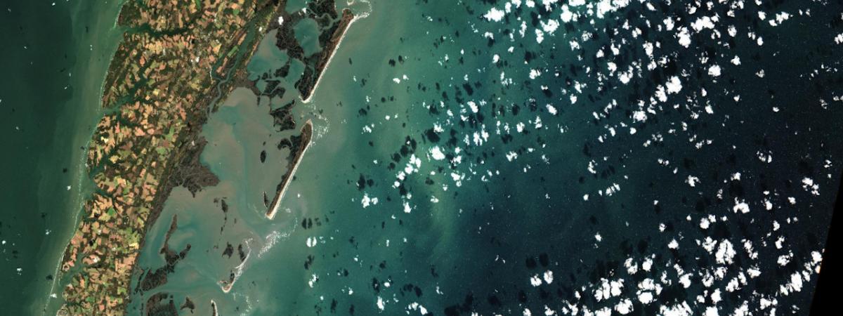
North Sea bloom
This true-colour image taken using Sentinel-3’s Ocean and Land Colour Instrument shows a significant algae bloom in the North Sea. It was taken on 27 May 2017.
©
contains modified Copernicus Sentinel data (2017), processed by ESA
Source Link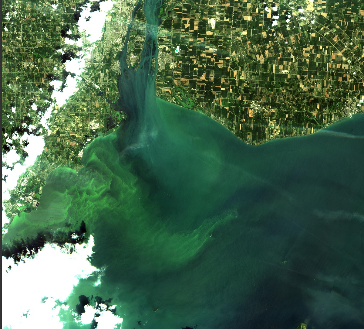
Algal Blooms in Lake Erie
This image shows Algal Blooms in Lake Erie, around Monroe, acquired by Sentinel-2 on 3rd August 2017
©
ESAS
Source LinkFeatured Video and Animations
No items found.

Sign up to our newsletter to get updates from Imperative MOOCs
Thank you! Your submission has been received!
Oops! Something went wrong while submitting the form.