

Back to futurelearn
Topic 5D - Estimating Precipitation
Featured Images and Example Data
No items found.
Featured Video and Animations
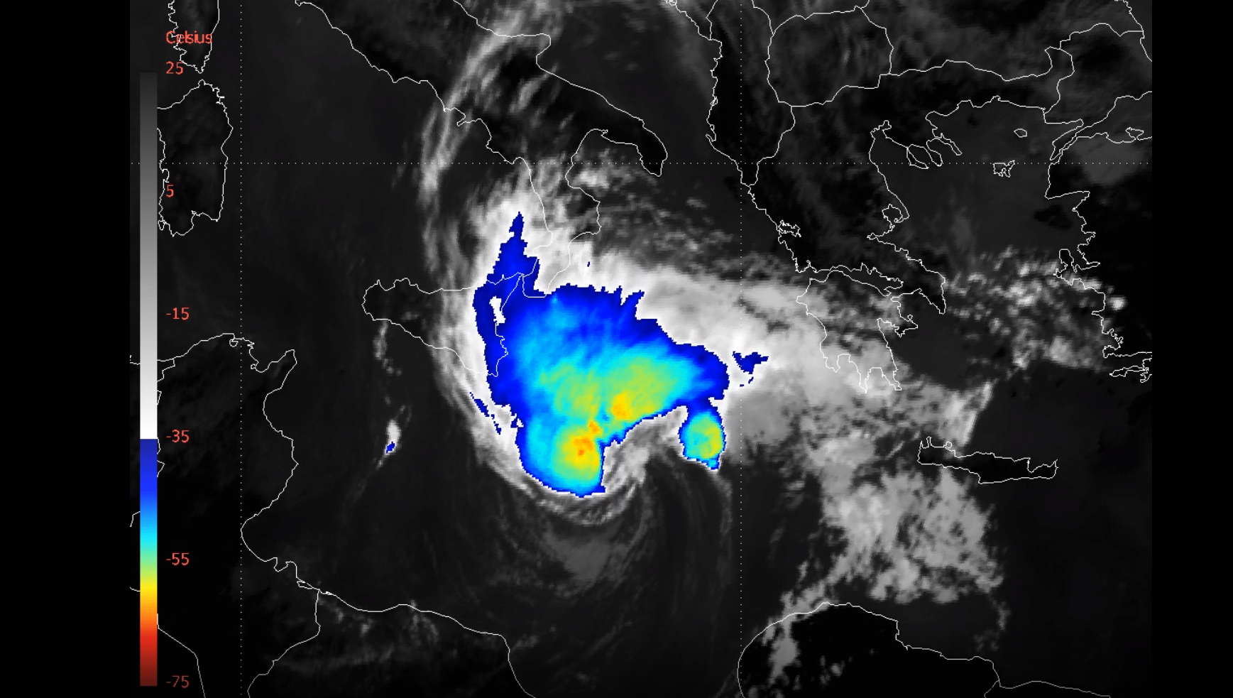
Medicane Ianos Meteosat-11
This video shows Meteosat-11 IR 10.8 Enhanced images, between 16 September –18 September 2020 of the Medicane Ianos tropical-like cyclone
©
EUMETSAT
Source Link
Copernicus Sentinel-6 ready for launch
Video showing the final preparations for the launch of Sentinel-6
©
ESA
Source Link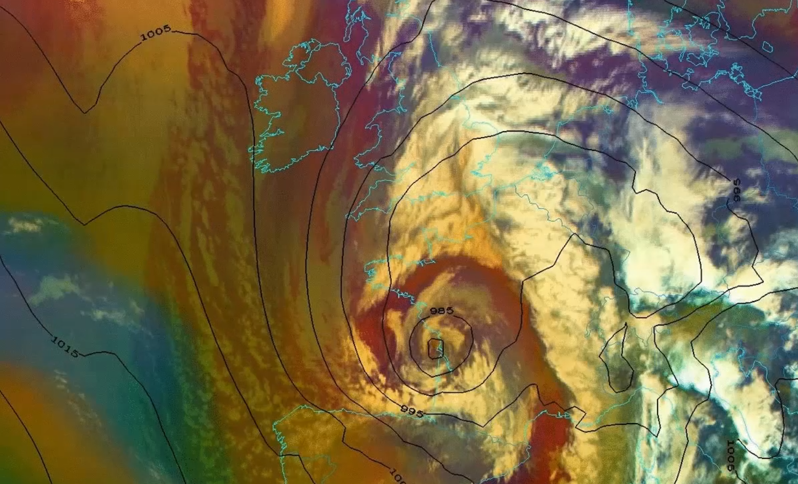
Strom Alex - Meteosat-11
Meteosat-11 Airmass RGB animation overlaid by ECMWF Mean Sea Level Pressure (hPa, black isolines) of Storm Alex moving across France 1 October - 4 October 2020
©
EUMETSAT
Source Link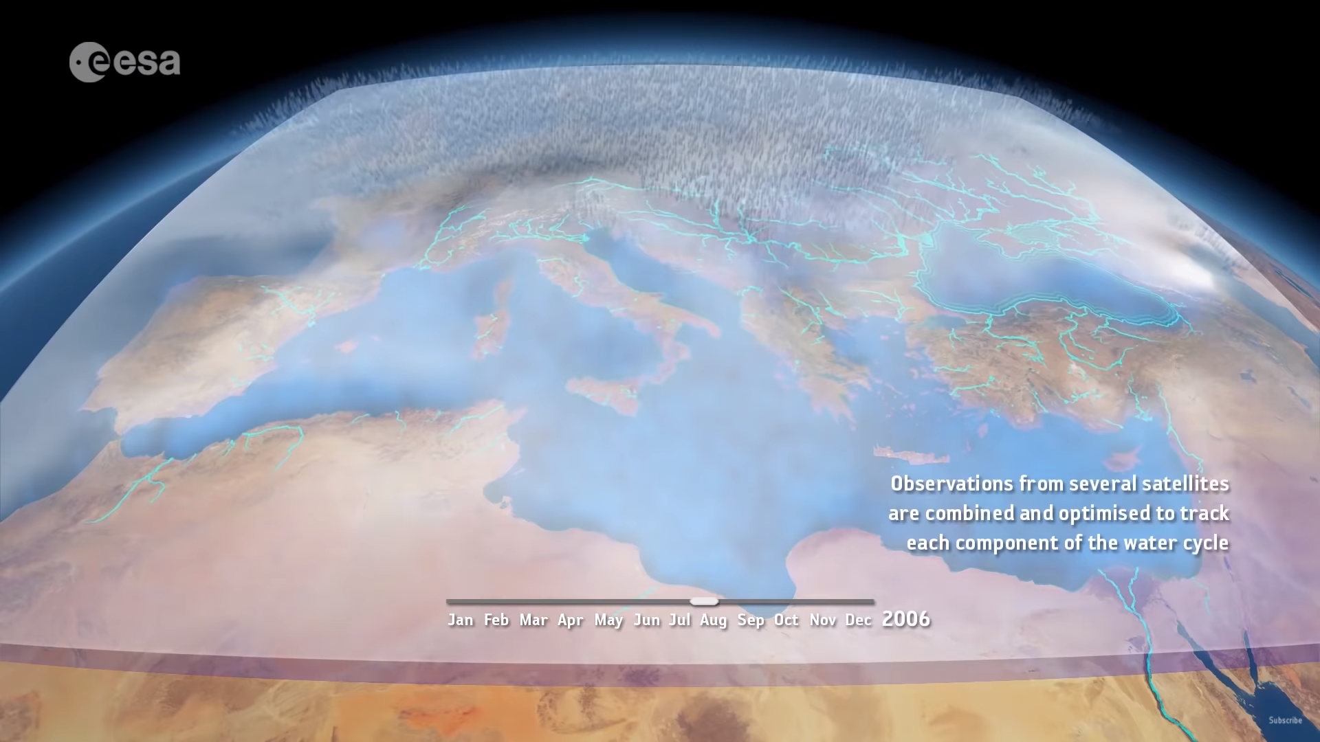
Mediterranean water cycle
A video by ESA on the Mediterranean water cycle
©
ESA/Planetary Visions
Source Link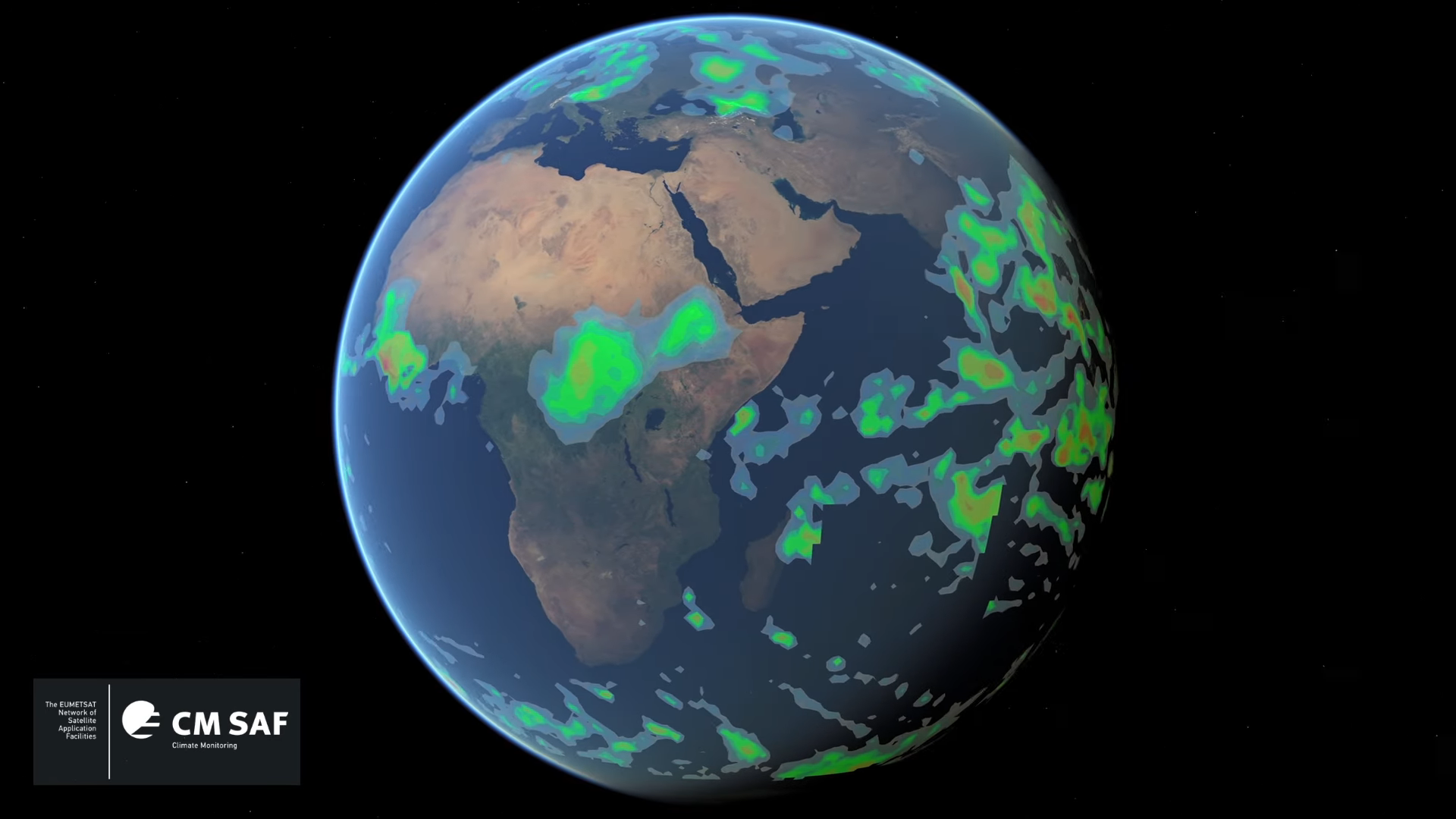
Global Rainfull
This visualisation shows a selection of severe weather events associated with extreme rainfall (precipitation) during July, August, September and October 2004, using information provided by the DAPACLIP project. The audio commentary is by Dr Mark Higgins.
©
EUMETSAT
Source Link
Sign up to our newsletter to get updates from Imperative MOOCs
Thank you! Your submission has been received!
Oops! Something went wrong while submitting the form.