
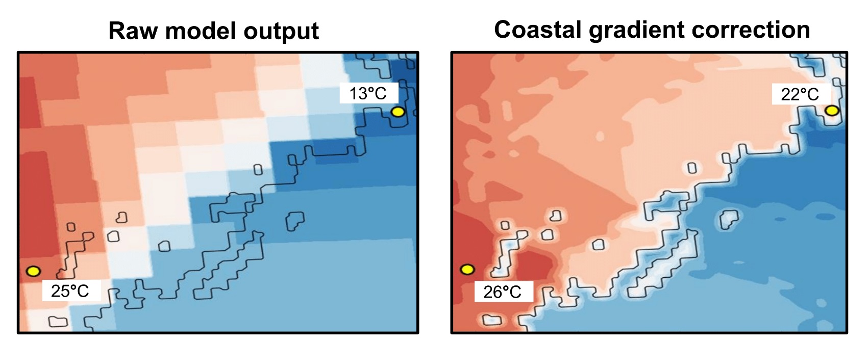
Downscaling along coastlines
These images show the downscaling process along a coastline. The raw model output is on the right, and the image on the left shows coastal gradient correction. Temperatures on the coast can be up to 10 degrees wrong - so land/ocean fraction can be used when interpolating to finer resolution
Met Norway
Image sourceBack to topic

Sign up to our newsletter to get updates from Imperative MOOCs
Thank you! Your submission has been received!
Oops! Something went wrong while submitting the form.