
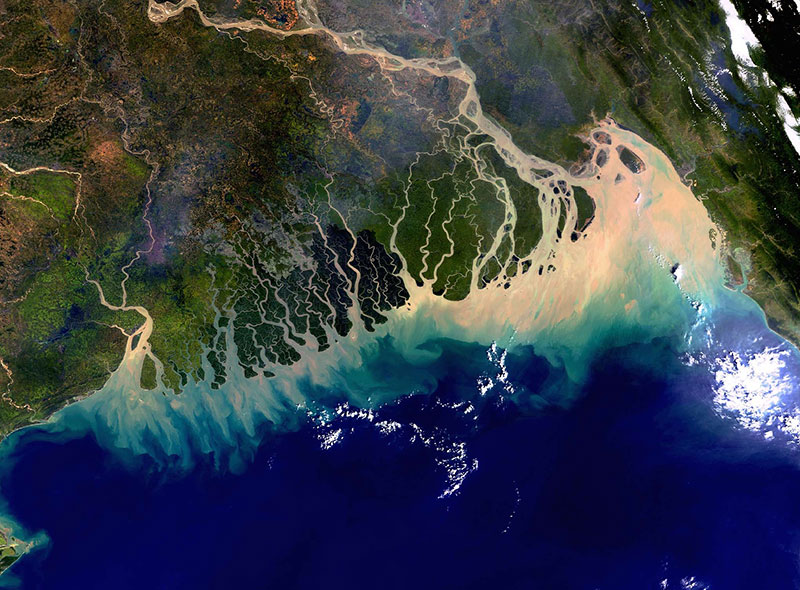
The Bangladesh coastline seen by Envisat
A colourful view of the Bangladesh coastline seen by Envisat's Medium Resolution Imaging Spectrometer (MERIS). The image was acquired on 8 November 2003 in Full Resolution mode, providing a spatial resolution of 300 metres and covering approximately 633 km by 630 km.
Contains modified Copernicus Sentinel data (2016), processed by ESA
Image sourceBack to topic

Sign up to our newsletter to get updates from Imperative MOOCs
Thank you! Your submission has been received!
Oops! Something went wrong while submitting the form.