
Topic 3D: Part 2 - AI for Agriculture: Food Security
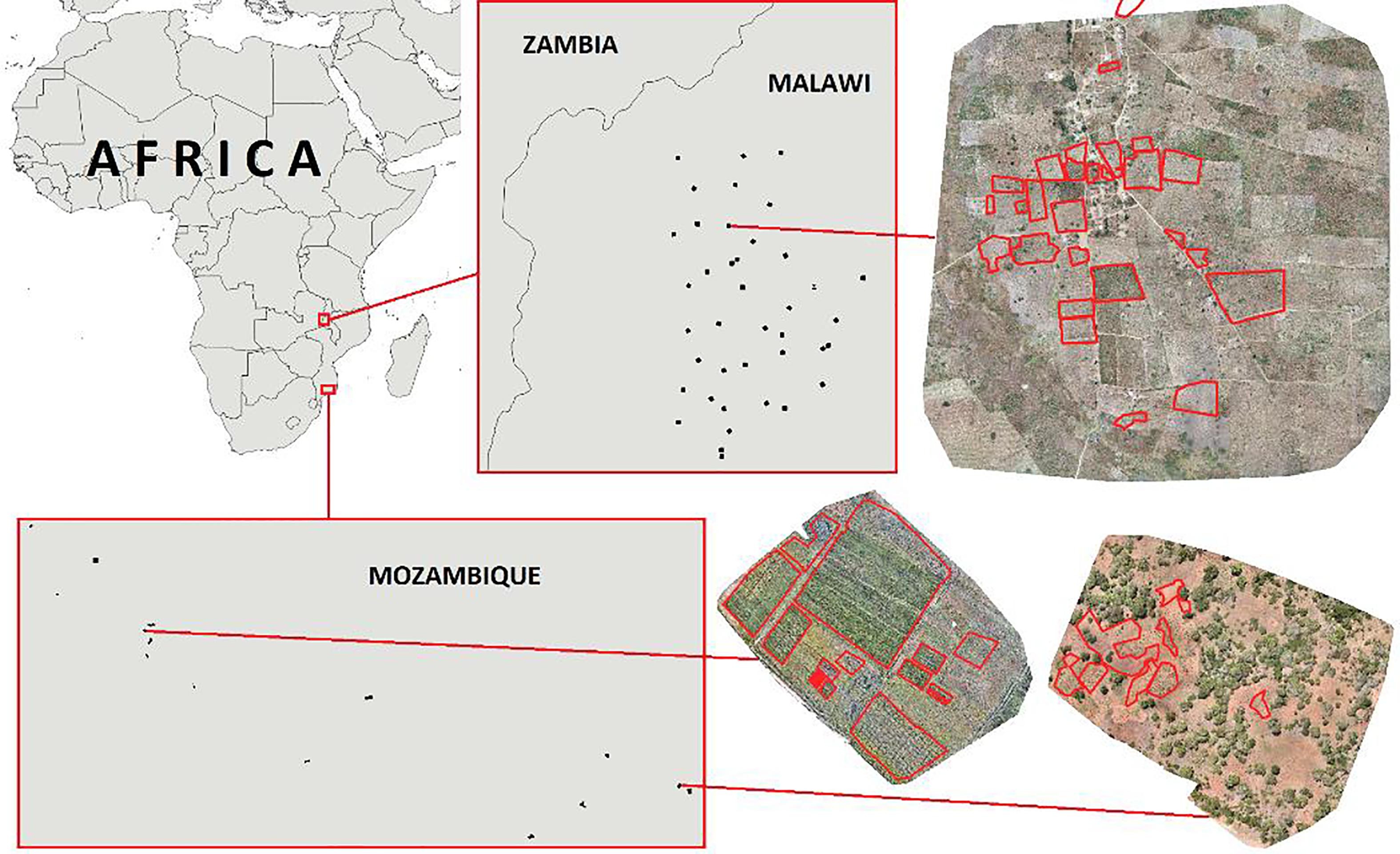
Crop mapping is important for many applications, especially those supporting environmental, economic and policy issues. PhiLab partnered with the World Food Programme, because they need accurate crop type information to help manage food supplies and children’s welfare in developing countries. Availability of new sensor platform and latest development in transferring models between different image domains create an opportunity to improve existing crop type mapping approaches.
This project was unprecedented attempt to fuse information extracted from images captured by satellites, drones and from cameras / smartphones.
Using three datasets of drone images acquired in Malawi and Mozambique, they found that transfer learning from computer vision could be successfully applied to crop type classification. It means that low-level visual information can also be learned from millions of images addressing a different applicative scenario (for example the distinction between cats and dogs). Moreover, the classified drone data can be used to increase the number and diversity of input samples needed by Sentinel-2 based classification systems (eg. Sen2Agri) which make use of multi-temporal information to increase the accuracy of crop types mapping. A key aspect is to provide a confidence level information together with the classification results to select only the most reliable samples
Featured Educator
- Sara Aparicio
©
