
Topic 6F - How ML Can Speed Up Our Response To Natural Disasters
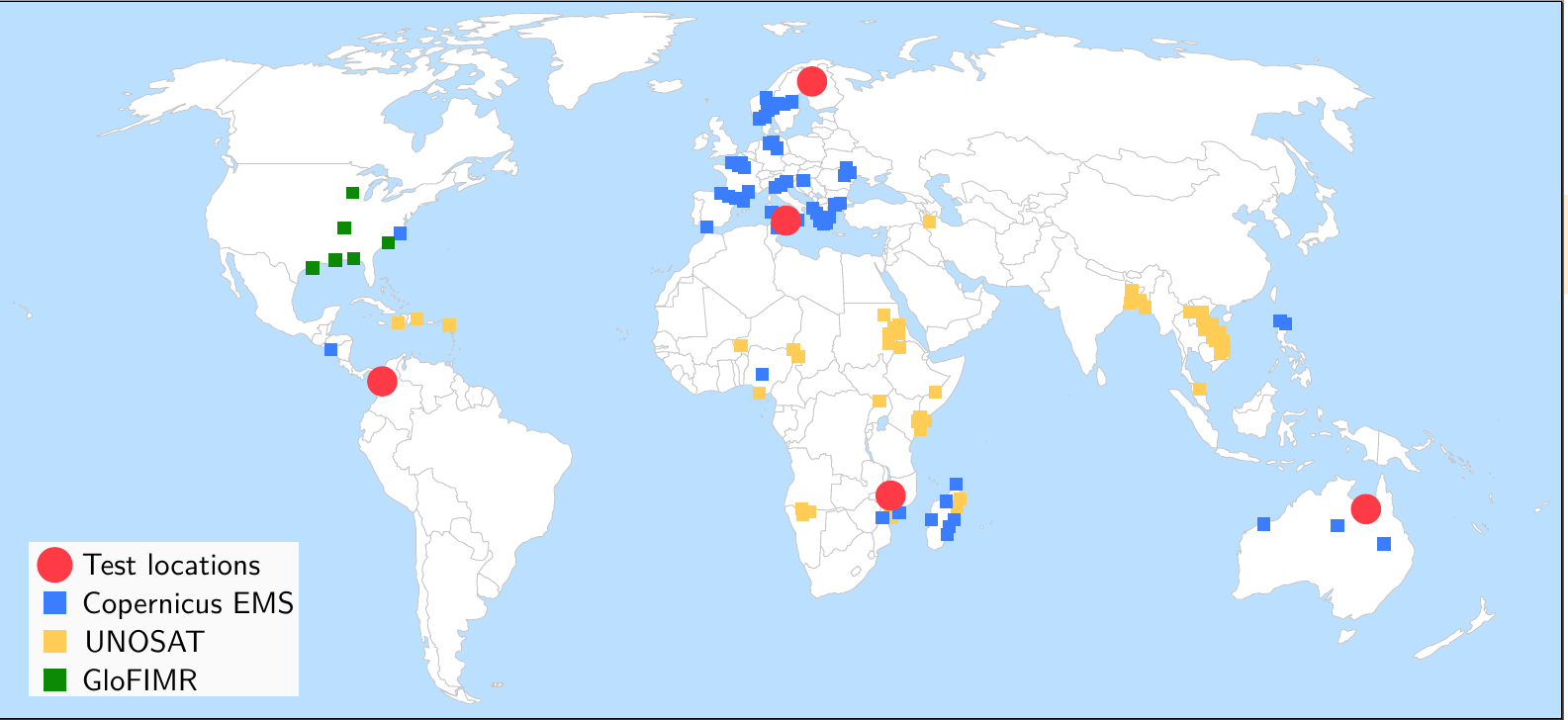
WorldFloods is a training data set that uses Sentinel 2 images to create flood segment maps.
The flood segment maps were mapped manually by specialist analysers, looking at Copernicus Emergency Management Service data and Sentinel 2 images. This is an expert data set that was labelled by flood experts – which means it has a higher confidence level and a higher accuracy. Typically this kind of expert labelling takes about six months of work.
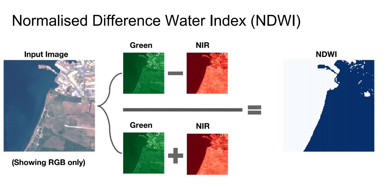
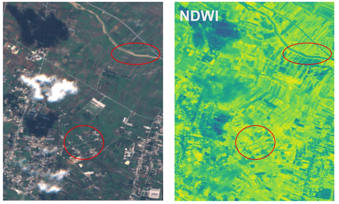
You need experts to label the dataset because it can be hard to identify what is a flood and what isn’t a flood. For example, a flood can look different depending on what colour composite you’re looking at.
The flood extent maps are used to help facilitate quicker and more effective responses to natural disasters. For examples, first responders can use them to deal with current emergencies to know where to deploy supports. Also, after the event they can also be used by people such as insurance companies to see what crops have been destroyed by floods. However, the Sentinel-2 imagery is not at a high enough resolution to determine building damage.
In the future, flood segmentation mapping will be able to be run on-board satellites. The new CubeSat satellites such as PhiSat include chips that can run the algorithm – which would significantly speed up response times. This is ultimately what the WorldFloods dataset will be used for.
Alternative Case Study: Volcanic Eruptions Detection Through Convolutional Neural Networks [PPM] Creating a neural network that can recognise eruptions with lava flows and can distinguish eruption smokes from clouds. This works provides a preliminary classification of the images to better recognise the ones in which a volcanic eruption is present. Potential contributor: Maria Pia Del Rosso (University of Sannio)
This could also be integrated with the FDL case study FL: Maria waiting on confirmation from her team to see if we can include this
©
©

©

